Key Takeaways
- Agricultural drone monitoring offers a high-tech solution for pest and disease surveillance in farming.
- Drones provide advantages such as cost-effectiveness, efficiency, and accessibility for monitoring agricultural pests and diseases.
- Drone sensors and imaging capabilities enable the detection and identification of pests and diseases in crops.
- Drone imagery allows for the mapping and monitoring of crop health, aiding in early identification of infestations and outbreaks.
- Integration of drone data with farm management systems and consideration of regulatory factors are crucial for the future of drone-assisted precision agriculture.
Introduction to Agricultural Drone Monitoring
As the global population continues to grow, the demand for food production has never been higher. Farmers and agricultural professionals are constantly seeking innovative ways to optimize crop yields, reduce input costs, and minimize the environmental impact of their operations. In this context, the emergence of precision agriculture and the use of drones have become increasingly important tools in the arsenal of modern farming.
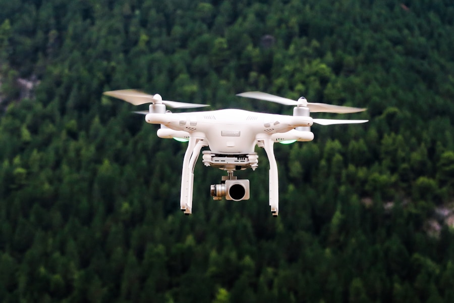
Drones, or unmanned aerial vehicles (UAVs), have revolutionized the way we approach agricultural monitoring and management. These versatile aerial platforms offer a unique perspective on crop health, allowing farmers to detect and respond to pests and diseases more effectively than ever before. By leveraging the power of drone-based remote sensing, growers can now access a wealth of data that was previously inaccessible or prohibitively expensive to obtain.
The integration of drones into agricultural practices has opened up new possibilities for precision farming. With their ability to cover large areas quickly and capture high-resolution imagery, drones can provide valuable insights into the overall condition of a crop, enabling early detection of potential problems before they become widespread. This proactive approach to pest and disease management can lead to significant cost savings, improved crop yields, and a more sustainable agricultural ecosystem.
The Advantages of Drone-Based Pest and Disease Surveillance
One of the primary advantages of using drones for pest and disease monitoring is the improved efficiency and coverage compared to traditional ground-based scouting methods. Manually inspecting every inch of a large farm or orchard can be a time-consuming and labor-intensive task, often leaving gaps in the overall assessment. Drones, on the other hand, can quickly and systematically survey an entire field or plantation, capturing high-resolution imagery that can be analyzed for signs of pests or disease.
Moreover, drones can access areas that would be difficult or impossible for human scouts to reach, such as remote or hard-to-access regions of the farm. This ability to cover a wider geographic area and identify problems in previously inaccessible locations is a significant advantage of drone-based monitoring. By catching issues early, farmers can take targeted action to address the problem before it has a chance to spread and cause widespread damage.
The cost-effectiveness and scalability of drone-based monitoring are also noteworthy benefits. Compared to traditional methods that may require extensive labor and specialized equipment, drones offer a more affordable and flexible solution. Farmers can deploy drones as needed, adjusting the frequency and coverage area to suit their specific requirements. This scalability allows for a more proactive and responsive approach to pest and disease management, ultimately leading to improved crop health and higher yields.
Drone Sensors and Imaging Capabilities for Pest and Disease Detection
The key to effective drone-based pest and disease monitoring lies in the sophisticated sensors and imaging capabilities that these aerial platforms can carry. Drones can be equipped with a variety of sensors, including RGB (red, green, blue) cameras, multispectral sensors, and thermal cameras, each of which can provide valuable insights into the health and condition of a crop.
RGB cameras capture standard color images, which can be used to visually identify signs of pests or disease, such as discoloration, wilting, or physical damage to the plants. Multispectral sensors, on the other hand, can detect subtle changes in the reflectance of light across different wavelengths, allowing for the identification of stress indicators that may not be visible to the naked eye. Thermal cameras, meanwhile, can detect variations in temperature, which can be indicative of pest infestations or disease outbreaks.
Advancements in image processing and data analysis techniques have further enhanced the capabilities of drone-based monitoring. By applying sophisticated algorithms and machine learning models, farmers and agricultural professionals can automate the detection and classification of pests and diseases, streamlining the decision-making process and enabling more timely interventions.
However, it’s important to note that current sensor technologies still have their limitations. Factors such as environmental conditions, crop type, and the specific nature of the pest or disease can all impact the effectiveness of drone-based detection. Ongoing research and development in this field are aimed at addressing these challenges and improving the reliability and accuracy of drone-based monitoring solutions.
Mapping and Monitoring Crop Health with Drone Imagery
| Drone Model | Flight Time | Max Range | Camera Resolution |
|---|---|---|---|
| Model A | 60 minutes | 5 km | 20 MP |
| Model B | 45 minutes | 3 km | 16 MP |
| Model C | 75 minutes | 7 km | 24 MP |
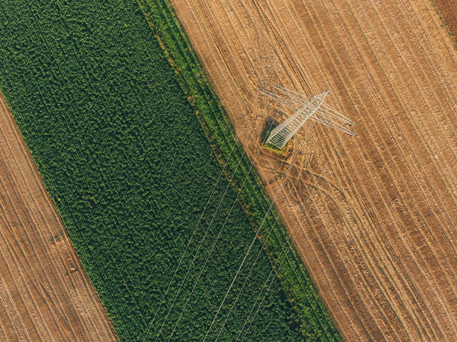
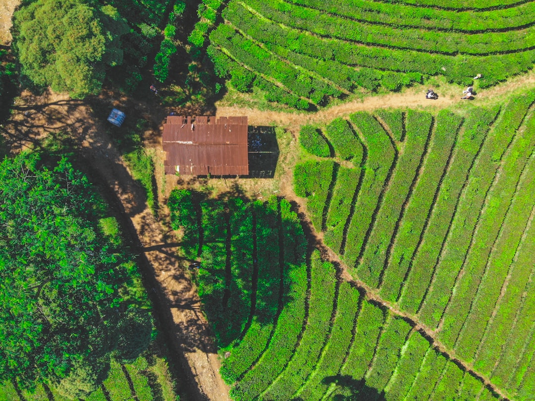
One of the most powerful applications of drone-based monitoring is the creation of high-resolution, georeferenced maps of crop health and vigor. By combining the aerial imagery captured by drones with precise GPS data, farmers can develop detailed maps that provide a comprehensive view of their fields or orchards.
These maps can be used to identify problem areas, such as patches of stunted growth or discolored foliage, and track the progression of pests or diseases over time. By analyzing these spatial patterns, growers can gain valuable insights into the underlying causes of crop health issues and make more informed decisions about targeted interventions.
The integration of drone-derived data with geographic information systems (GIS) further enhances the utility of these crop health maps. GIS software allows for the overlay and analysis of multiple data layers, such as soil moisture, nutrient levels, and historical yield data, providing a holistic understanding of the factors influencing crop performance.
This data-driven approach to precision farming opens up new possibilities for optimizing input application, such as targeted pesticide or fungicide spraying. By precisely delineating the affected areas within a field, farmers can reduce the overall amount of chemicals used, leading to cost savings and a lower environmental impact.
Early Identification of Pest Infestations and Disease Outbreaks
The timely detection of pests and diseases is crucial for effective management and mitigation. Early identification allows farmers to take proactive measures before the problem escalates, potentially preventing significant crop losses and reducing the need for more intensive and costly interventions.
Drone-based monitoring can play a pivotal role in this early detection process. By regularly surveying their fields or orchards, growers can quickly identify emerging issues and respond accordingly. For example, drone imagery may reveal the first signs of a fungal disease or the presence of a new pest species, enabling the farmer to take targeted action before the problem spreads.
The integration of drone data with predictive models and decision support systems can further enhance the effectiveness of early detection efforts. By combining real-time drone observations with historical data, weather patterns, and other relevant information, these systems can provide early warning alerts and recommendations for appropriate management strategies.
However, it’s important to note that while drone-based monitoring can significantly improve the timeliness of pest and disease detection, there are still limitations and considerations to be addressed. Factors such as weather conditions, crop canopy density, and the specific characteristics of the pest or disease can all impact the reliability and accuracy of drone-based detection. Ongoing research and collaboration between farmers, researchers, and technology providers are essential for overcoming these challenges and maximizing the potential of drone-assisted early identification.
Precision Targeting of Problem Areas for Intervention
One of the key advantages of drone-based monitoring is the ability to precisely locate and delineate affected areas within a field or plantation. By capturing high-resolution imagery and leveraging advanced data analysis techniques, farmers can identify the specific regions that require targeted intervention, whether it’s the application of pesticides, fungicides, or other management strategies.
This precision targeting approach offers several benefits. First, it allows for a more efficient and cost-effective use of inputs, as growers can focus their efforts on the problem areas rather than treating the entire field or orchard indiscriminately. This not only reduces input costs but also minimizes the environmental impact by reducing the overall amount of chemicals used.
Furthermore, the ability to precisely target problem areas can lead to improved efficacy of pest and disease management strategies. By applying the necessary treatments only to the affected regions, farmers can ensure that the intervention is directed where it is most needed, maximizing the impact and reducing the risk of developing resistance or other unintended consequences.
However, the implementation of targeted treatment strategies based on drone-derived data is not without its challenges. Integrating the drone data with existing farm equipment and application systems, as well as ensuring accurate and timely application of the necessary treatments, can require additional technological and logistical considerations. Ongoing collaboration between farmers, equipment manufacturers, and technology providers is crucial for overcoming these hurdles and fully realizing the benefits of precision targeting.
Integrating Drone Data with Farm Management Systems
As the use of drones in agriculture becomes more widespread, the seamless integration of drone-derived data with existing farm management systems is becoming increasingly important. By seamlessly incorporating drone-based observations and insights into their overall farm management strategies, growers can unlock the full potential of precision agriculture and data-driven decision-making.
The integration of drone data with farm management software allows for a more comprehensive and holistic approach to crop monitoring and decision-making. Farmers can now access a wealth of information, from high-resolution crop health maps to detailed pest and disease monitoring reports, all within their familiar farm management platforms. This integration enables data-driven decision-making, allowing growers to make more informed choices about input application, crop management, and resource allocation.
However, the successful integration of drone data with farm management systems requires careful consideration of data storage, processing, and sharing among various stakeholders. Ensuring data security, privacy, and interoperability between different software platforms and hardware systems is crucial for the widespread adoption and effective utilization of drone-based precision agriculture solutions.
As the agricultural industry continues to embrace digital technologies, the development of comprehensive, data-driven farm management platforms that seamlessly incorporate drone-derived insights will be a key driver of the precision farming revolution. By leveraging the power of these integrated systems, farmers can optimize their operations, improve crop yields, and enhance the overall sustainability of their agricultural practices.
Regulatory Considerations for Agricultural Drone Use
The use of drones in agriculture is subject to a range of regulatory considerations that must be carefully navigated by farmers and agricultural professionals. As the technology continues to evolve, the regulatory landscape is also constantly shifting, requiring ongoing engagement and compliance with local, national, and international guidelines.
One of the primary regulatory concerns surrounding agricultural drone use is airspace restrictions and safety requirements. Drones must operate within designated airspaces and adhere to specific rules and regulations to ensure the safety of other aircraft, as well as the general public. Compliance with these regulations, which may vary depending on the location and the type of drone being used, is essential for the legal and responsible deployment of drone-based monitoring and management strategies.
In addition to airspace regulations, the use of drones in agriculture also raises concerns about privacy and data security. Farmers and agricultural professionals must be mindful of the potential impact of drone-captured imagery on the privacy of neighboring landowners or workers, and ensure that any data collected is handled and stored in a secure and responsible manner.
As the adoption of agricultural drones continues to grow, policymakers and regulatory bodies are working to develop guidelines and frameworks that balance the benefits of this technology with the necessary safeguards. Ongoing collaboration between the agricultural community, drone manufacturers, and regulatory authorities is crucial for shaping a regulatory environment that supports the responsible and effective use of drones in precision farming.
The Future of Drone-Assisted Precision Agriculture
As the agricultural industry continues to embrace the power of digital technologies, the future of drone-assisted precision farming holds immense promise. Advancements in drone hardware, sensor capabilities, and data analysis techniques are poised to drive further innovations in the field of agricultural monitoring and management.
One exciting development on the horizon is the potential for autonomous or semi-autonomous drone operations. As drone technology becomes more sophisticated, the ability to program drones to perform routine monitoring tasks without the need for constant human intervention could significantly enhance the efficiency and scalability of drone-based precision agriculture solutions.
Furthermore, the integration of drones with other precision agriculture technologies, such as robotics and artificial intelligence, could lead to the development of comprehensive, data-driven farm management platforms. These integrated systems would be able to not only detect and identify pests and diseases but also recommend and implement targeted interventions, optimizing crop inputs and enhancing overall farm productivity.
As the world faces the challenge of feeding a growing population while minimizing the environmental impact of agricultural practices, the role of drone-assisted precision farming will become increasingly crucial. By leveraging the power of these aerial platforms to monitor crop health, detect emerging problems, and optimize resource allocation, farmers and agricultural professionals can work towards a more sustainable and efficient future for the industry.
Ongoing research, technological advancements, and collaborative efforts between the agricultural community, technology providers, and policymakers will be essential in shaping the future of drone-assisted precision agriculture. As this field continues to evolve, the potential benefits for improving crop yields, reducing input costs, and enhancing environmental sustainability are truly transformative for the future of global food production.
FAQs
What is agricultural drone monitoring for pests and diseases?
Agricultural drone monitoring for pests and diseases involves the use of unmanned aerial vehicles equipped with specialized sensors and cameras to detect and monitor the presence of pests and diseases in crops.
How does agricultural drone monitoring work?
Agricultural drones are equipped with high-resolution cameras and sensors that can capture images and data of crops. This data is then analyzed using specialized software to identify signs of pests and diseases, such as discoloration, wilting, or unusual patterns.
What are the benefits of using agricultural drones for pest and disease monitoring?
Using agricultural drones for pest and disease monitoring can provide early detection of issues, allowing farmers to take targeted and timely action to mitigate the impact on their crops. This can lead to improved crop yields, reduced use of pesticides, and overall cost savings.
Are there any limitations to agricultural drone monitoring for pests and diseases?
While agricultural drone monitoring can be effective, it is not a standalone solution. It should be used in conjunction with other pest and disease management practices, such as regular scouting and integrated pest management strategies. Additionally, weather conditions and the size of the area to be monitored can impact the effectiveness of drone monitoring.
Is agricultural drone monitoring widely used in the agriculture industry?
Agricultural drone monitoring is gaining popularity in the agriculture industry, particularly among larger farms and commercial operations. However, the technology is still evolving, and its widespread adoption may depend on factors such as cost, regulations, and the availability of skilled operators.


